CRASSH Orbital Reveries
Instructions
To get started, click "Open viewer" and then navigate the scene using the arrow keys on your keyboard, or the pop up arrows on the screen. Move the central crosshair over a textual label to activate a caption. If the crosshair becomes hard to see, you can click on it to change the colour - although, it should be noted, it is meant to be somewhat obscure.
Labels marked as "Gateway" will transport you to a new map scene - follow these gateways to explore all the maps!
Description
This piece was created as part of the CRASSH research workshop "Exploring Practices between the Arts, Sciences, and Humanities", University of Cambridge, April 20-21 2023. The full event programme can be found at this link here. This workshop was conducted as part of the CRASSH research network "Remote Sensing: Ice, Instruments, Imagination." Further details of this network can be found at this link here.
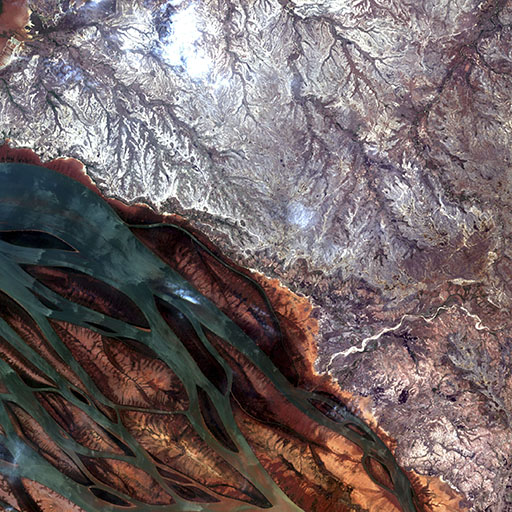
Each "scene" is a satellite image that was annotated by members of the five working groups for this exercise, in response to their own thoughts and associations concerning the image itself, and their own understandings of what "remote sensing" means. The members of each group are credited in the opening caption of each scene.
This workshop was led by Richard A Carter, who also created the "satellite parser" utility for this exercise. Further details of Carter's academic and artistic practices can be found at this link here.
All images used are courtesy of the ESA Copernicus Sentinel 2 mission, which are licenced under the Open Access compliant Creative Commons CC BY-SA 3.0 IGO licence. To see a ready stream of beautiful images from Sentinel 2, take a look at https://twitter.com/Sentinel2Bot.